White Mountain Apache History |
 |
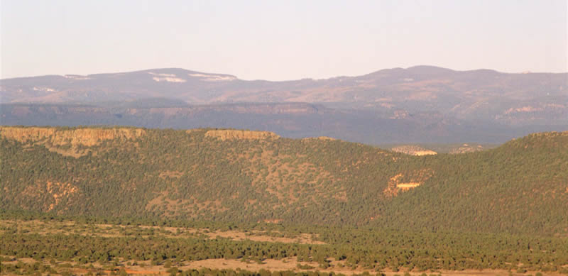
This land that is now the White Mountain Apache Reservation We were placed here under the White Mountain by our Creator at the beginning. In this land our ancestors learned to be Ndee—The People—and we have learned from them. There are many different nations of Apache people. We are Western Apache, closely related to the people of San Carlos, Payson, and Camp Verde. Though there are differences in language, history, and culture, we are also related to the other Apache nations: the | |
| Chiricahua, Mescalero, Jicarrilla, Lipan, and Kiowa-Apache peoples. When Europeans began to visit our lands, our people lived in family groups and bands, with homes and farms along all of the major watercourses: the East Fork and North Fork of the White River, on Cedar Creek, Carrizo Creek, Cibecue Creek, Oak Creek, and others. They farmed, growing corn, sunflowers, beans, squash, and other foods. They hunted deer and other game and collected abundant wild plant foods. They traveled widely, trading and raiding throughout the region and deep into Mexico. When the United States took control of New Mexico during the Mexican-American War, some of our leaders went to Santa Fe to meet with those authorities. By the time the U.S. Army came to our lands, our people knew much more about them than they did about us. |
 |
Fort Apache |
|
 |
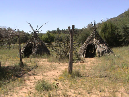
In July 1869 Brevet Colonel (Major) John Green of the U.S. 1st Cavalry led a scouting expedition of more than 120 troops into the White Mountains area from Camp Goodwin and Camp Grant to the south. Seeking to kill or capture any Apache people they encountered, the expedition headed north up the San Carlos River, across the Black River, and to the White River in the vicinity of the future site of Fort Apache. Army scouts reported finding over 100 acres of cornfields along the White River. Escapa--an Apache chief that the Anglos called Miguel--visited the camp, and invited Col. Green to visit his village. Green sent Captain John Barry, urging him “if |
possible to exterminate the whole village.” Green returned to the White Mountains in November, and met again with the Apache leaders Escapa (Miguel), Eskininla (Diablo), Pedro, and Eskiltesela. They agreed to the creation of a military post and reservation, and directed Green to the confluence of the East and North Forks of the White River: I have selected a site for a military post on the White Mountain River which is the finest I ever saw. The climate is delicious, and said by the Indians to be perfectly healthy, free from all malaria. Excellently well wooded and watered. It seems as though this one corner of Arizona were almost its garden spot, the beauty of its scenery, the fertility of its soil and facilities for irrigation are not surpassed by any place that ever came under my observation. Building material of fine pine timber is available within eight miles of this site. There is also plenty of limestone within a reasonable distance. This post would be of the greatest advantage for the following reasons: It would compel the White Mountain Indians to live on their reservation or be driven from their beautiful country which they almost worship. It would stop their traffic in corn with the hostile tribes, they could not plant an acre of ground without our permission as we know every spot of it. It would make a good scouting post, being adjacent to hostile bands on either side. Also a good supply depot for Scouting expeditions from other posts, and in fact, I believe, would do more to end the Apache War than anything else.The following spring troops from the 21st Infantry and 1st Cavalry were ordered to establish "a camp on the White Mountain River ." |
|
| On May 16, 1870 they began construction of Camp Ord. Over the course of the next year, the remaining troops at Camp Goodwin moved to the site, and the camp would be renamed Camp Mogollon, then Camp Thomas , and finally, Camp Apache . The post was designated Fort Apache in 1879. The Army abandoned Fort Apache in 1922. In 1923 the site became the home of the Bureau of Indian Affairs’ Theodore Roosevelt Indian Boarding School . First intended to serve Diné (Navajo) children, by the 1930s a majority of students at the school were Apache. Today T.R. School continues to serve as a middle school, under the administration of a school board selected by the Tribal Council. |
 |
The Apache Scouts |
|
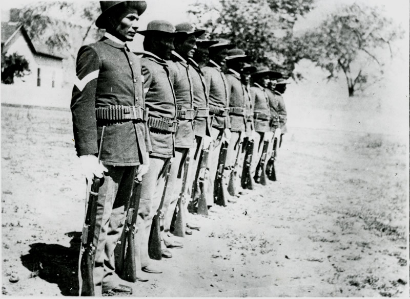 |
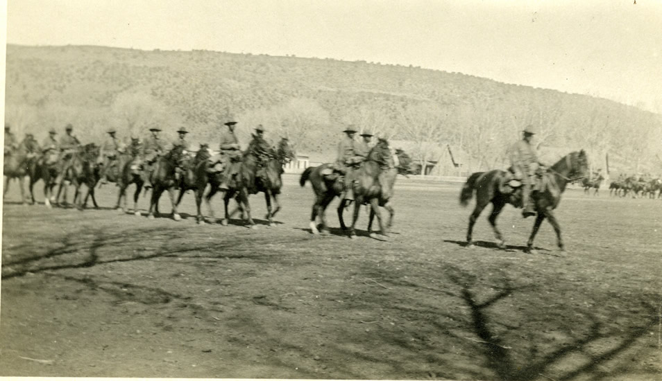
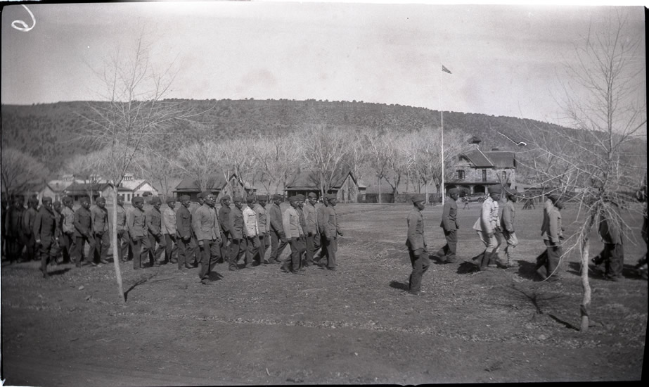
In 1871 General George Crook was named commander of the Department of Arizona. Crook recognized that his regular soldiers were no match for the Native people he was sent to subdue, so he enlisted the aid of Indian men as scouts. In August 1871 he made his first visit to Fort Apache and engaged about 50 men from Pedro and Miguel’s bands to serve as Apache Scouts. The Scouts would play a decisive role in the success of the Army in the so-called “Apache Wars” of the next fifteen years, ending with the final surrender of the Chiricahua leader Geronimo in 1886. In part because of the Scouts’ service, our ancestors were able to maintain a portion of our homeland as the White Mountain Apache Reservation. When Fort Apache was abandoned by the Army in 1922, the Apache Scouts transferred to Fort Huachuca in southern Arizona , where they |
| continued to serve until the last three Apache Scouts retired in 1947. (http://huachuca-www.army.mil/HISTORY/museum.htm) | |
| The White Mountain Apache Tribe Today |
|
 |
The White Mountain Apache Tribe now consists of approximately 15,000 members. Many live here on our Tribal lands, but others live and work all over the country and the world. The majority of the population lives in and around Whiteriver, the seat of Tribal government, with others residing in the communities of Cibecue, Carrizo, Cedar Creek, Forestdale, Hon-Dah, McNary, East Fork, and Seven Mile. The Whiteriver Unified School District and the Cibecue Community School offer public education. Other educational institutions include the Theodore Roosevelt School and John F. Kennedy School operated by the Indian Education Division of the Bureau of Indian Affairs, and the East Fork Lutheran Mission School . Higher Ed opportunities are available through the regional Northland Pioneer College, which has |
| a center at Whiteriver. Many Apache young people attendArizona ’s three state universities and other schools and colleges around the country. | |
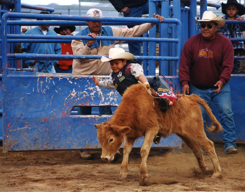
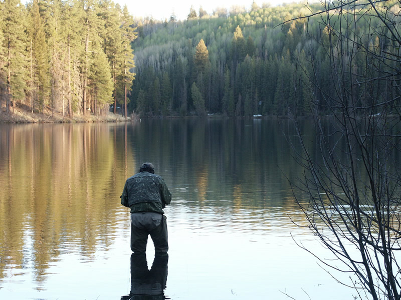
Our reservation consists of 1.67 million acres (over 2,600 square miles) in east-central Arizona . It ranges in elevation from 2,600 feet in the Salt River Canyon on the southwest corner of the reservation to over 11,400 feet at the top of Mount Baldy , one of our sacred peaks. It includes some of the richest wildlife habitats in the state, and more than 400 miles of streams. It is home to the Apache trout, a species brought back from the brink of extinction through the efforts of the Tribe and many partners. Through the Tribe’s Wildlife and Outdoor Recreation Division, many recreational opportunities are available on the reservation. |
 |